

Hello, everyone.
This is Enta.
With the trends of the past few years, the construction industry has been flooded with terms like ICT, DX, AI, and 3D data, hasn't it?
To be honest, when I'm out in the field, I find myself wondering, "Can we really use that in a legal setting?"
I think a lot of people probably think that.
I mean, the director uses it quite a bit, but I'm wondering, "What's it really like?"
If you work in earthwork, you'll understand. You attach machine guidance to a backhoe, use an automated system to control the bulldozer, and use a drone to measure the volume of soil.
Well, it's easy to picture.
But slope stabilization isn't really that simple, is it?
The slope is steep, and the ground is uneven.
Install the formwork, drive in the anchors, spray the mortar, assemble the formwork frame, inspect the finished surface, take photos, and prepare the documentation.
That's the thing about slopes—nothing ever goes exactly as planned, lol.
This time, I’ll write a simple guide for slope construction professionals.
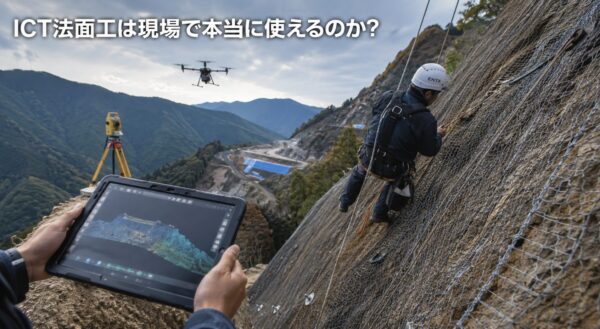
What Kind of Construction Work Is ICT Slope Stabilization?
According to documents from the Ministry of Land, Infrastructure, Transport and Tourism and the National Institute for Land and Infrastructure Management, ICT slope stabilization is defined as the use of ICT in the construction process for slope stabilization.
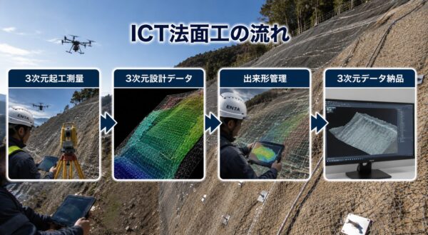
Main Steps in ICT Slope Stabilization
The document primarily outlines the following process.
- 3D As-Built Survey
- Creation of 3D Design Data
- Construction Management, Including 3D As-Built Management
- Delivery of 3D Data
However, ICT slope stabilization work is treated as a related construction category of ICT earthwork.
In other words, rather than slope stabilization work being the only area to undergo a complete and sudden transition to ICT on its own, I think it’s more accurate to view it as the use of 3D data being integrated into the slope stabilization process as part of the overall earthwork and cut operations.
Surveying and as-built management are easy to use on-site.
So, does that mean we can't use ICT slope stabilization methods?
I think it would be quite useful if we could distinguish between the parts that are ready for use and those that still require human judgment.
Surveying for the start of construction is a great fit.
In the old days, surveying slopes meant sending people into dangerous areas, where they would take measurements, drenched in sweat, using a tape measure, a surveying staff, and a prism.
Of course, there are still situations where it’s necessary.
However, using UAV photogrammetry, laser scanners, total stations, GNSS, and other technologies makes it easier to obtain a 3D understanding of areas that are difficult for people to access.
This technology has the potential to reduce the risks associated with sending personnel into particularly hazardous slopes, post-collapse sites, disaster recovery areas, and steep slopes—all for the sole purpose of surveying.
In fact, our company also provides drone-based surveying and quantity surveying services to our first-tier subcontractors.
Serves as explanatory material for as-built management
Even in as-built inspection, there are situations where having 3D data makes it easier to explain things.
For example, show the client or general contractor the differences between before and after construction. Overlay design data with actual measurement data. Use a heat map to verify the as-built condition.
In some cases, these are easier to understand than explanations based solely on paper drawings and photographs.
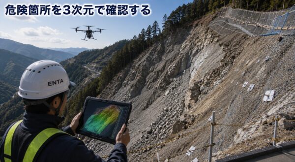
Slope stabilization cannot be completed with ICT alone
However, ICT is not a panacea.
Trees blocking the way, overhangs, spring water, darkness, narrow passages, power lines nearby.
There are plenty of workplaces like that.
On-site judgment is still required for slope stabilization work
Not every construction site—whether it involves framing or mortar spraying—proceeds smoothly and exactly according to the blueprints.
In areas where the natural ground undulates, even if you only look at the beautiful 3D model that matches the design data, the question “How are we going to fit this in here?” is bound to come up on site.
Rope work, the texture of the sprayed surface, changes in the natural ground, the sound of drilling, and how the spring water flows.
In this area, human experience still plays a major role.
ICT is a tool.
So, what you're saying is that it doesn't take over the entire decision-making process for you.
Of course, when viewed purely as a tool, it’s only natural that it has both good and bad aspects.
So, use it wisely.
The next step is to train people who can interpret the data.
If you're actually going to use it on-site, the real issue isn't the software or the equipment—it's "who knows how to use it."
They’ve handed the entire project over to an outside contractor capable of creating 3D data, and the site supervisor doesn’t understand the details.
At this rate, I probably won't be able to use it all up.
Can you explain what a heat map is?
Even if a heat map for as-built inspection appears,
- What does this red area mean?
- How should we explain this in relation to the standard values?
- Can this be used for design changes?
- How to Present the Results of the Examination
If the people on the ground don't understand this, it'll just end up being a pretty presentation, lol.
I think what’s really important in ICT slope engineering isn’t buying machinery, but ensuring that the people on-site are able to read 3D data.
For those who aren't familiar with this, here's a quick overview:
- Warm colors (red and orange): Areas that are higher than the design specification (insufficient material removal)
- Cool colors (blue and light blue): Areas that are lower than the design level (over-excavation or under-excavation)
- Green: Areas that meet the design specifications for height and shape
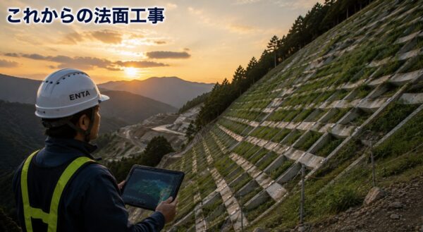
ICT slope stabilization technology will be a tool that supports future construction sites.
The Ministry of Land, Infrastructure, Transport and Tourism describes i-Construction as an initiative aimed at improving productivity at construction sites through the use of ICT.
In the construction sector, the declining working-age population has been identified as a challenge, and there is a growing trend toward improving productivity and ensuring safety.
The number of people is decreasing.
Young people don't come in.
But the field work won't go away.
When you think about it that way, ICT slope engineering isn’t something you use just because “it seems convenient”—it’s a tool you should learn to use in order to manage construction sites going forward.
You don't have to do it perfectly from the start.
First, let's take a look at the results of the drone survey.
Use the iPhone's LiDAR.
Let's try working with point clouds.
Let's try using a heat map in the client briefing.
Let's compare the as-built photos with the 3D data side by side.
I think that's about right.
These days, government offices are pretty up to date, and the software is quite user-friendly, so it’s easy to do.
Slope construction work has long been considered dangerous, grueling, and specialized.
That is precisely why we need to use new tools to make the workplace just a little safer, just a little easier to understand, and just a little more welcoming to young people.
ICT slope stabilization isn't magic.
Still, as long as you use it correctly, I think it can be a valuable tool that makes work on-site easier.
CSPI2026 will be held at Makuhari Messe next week.CSPI2026
I'm going on the 18th too, so if you see me, say hi lol
Let's explore these new technologies and the latest software, and think about what the future holds!
See you later.
The ICT Wave Shows No Signs of Stopping | Construction ICT and Drone Deployment Map