


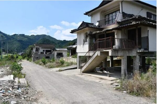
I went to see the progress of the restoration work on the Kuma River one year after the flood
It has been one year since the “Reiwa 2 July Heavy Rains.”
In the Kuma River basin, which suffered the most severe damage, restoration work on rivers, roads, and other infrastructure is still underway. In January of this year, the Kuma River System Emergency Flood Control Measures Project was formulated, and new river management measures—including flow-through dams, river channel dredging, embankment construction, and flood detention basins—will now be implemented in earnest.
On the other hand, the JR Hisatsu Line, which runs along the Kuma River, also suffered significant damage—including station buildings and tracks being swept away and tracks being buried under sediment—but with no prospect of restoration in sight, much of the line remains virtually untouched since the disaster. Service remains suspended to this day.
When I visited the Kuma River in late June, with the cooperation of the Yatsushiro Reconstruction Office of the Kyushu Regional Development Bureau, I had the opportunity to drive approximately 50 km along the Kuma River from Hitoyoshi City to Yatsushiro City to inspect the restoration sites. This report details the current state of the disaster-affected areas one year later.
Visited the disaster-stricken area with staff from the Yatsushiro Reconstruction Office
The Yatsushiro Reconstruction Office is primarily responsible for restoration and reconstruction work on the Kuma River and roads. It was originally established in September 2020 as the Yatsushiro Reconstruction Branch Office within the Yatsushiro River and National Highway Office. In April 2021, it was reestablished as the Yatsushiro Reconstruction Office. The office is primarily responsible for river restoration work on the Kuma River (from Yatsushiro City to Hitoyoshi City) and road restoration work on National Route 219 along roughly the same section (acting on behalf of the competent authority).
The distance from the reconstruction office near Shin-Yatsushiro Station on the Kyushu Shinkansen to the disaster recovery site (Hitoyoshi City) is about 50 km. National Route 219, which was damaged in this disaster, connects Yatsushiro City and Hitoyoshi City. However, even before the disaster, it was rarely used as a route between Yatsushiro and Hitoyoshi; in reality, the Kyushu Expressway was almost exclusively used for travel between the two cities. This is because while the trip takes about an hour and a half on local roads, it takes only about 30 minutes via the Kyushu Expressway.
Since the disaster, the section of the Kyushu Expressway between the Yatsushiro Interchange and the Hitoyoshi Interchange has been designated as a toll-free route to serve as an alternative to the damaged National Route 219, and residents reportedly welcome this change, saying it has “made getting around more convenient.” Given that service on the JR Hisatsu Line has been suspended, it is no exaggeration to say that the Kyushu Expressway is supporting the daily lives of local residents.
For this reporting trip, the Yatsushiro Reconstruction Office gave us a ride in one of their vehicles, and we traveled to Hitoyoshi City via the Kyushu Expressway. We then drove along National Route 219, observing the restoration sites along the way, before returning to the office.
Wata District, Kuma Village, where the temporary bridge has been completed
Emergency repairs on the section of National Route 219 between Yatsushiro and Hitoyoshi were completed shortly after the disaster, and the road is now open to traffic; however, access is limited to residents, emergency vehicles, and certain other vehicles, and general vehicle traffic remains prohibited in principle. General vehicles require a permit to use this section of the road.
This is because an increase in traffic—such as from sightseeing vehicles—could interfere with construction work being carried out in the area. The duration of the traffic restrictions has not yet been determined, and they are expected to remain in place for the time being. Incidentally, when I visited last August, I was turned away because I did not have a permit.
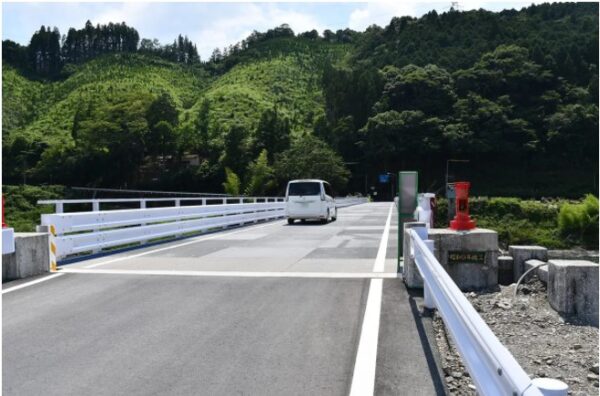
After exiting the expressway and turning onto National Route 219, we drove for a while before the Wata district of Kuma Village came into view. This was a place I had covered in detail during my previous visit. While several houses still stood damaged, some had been demolished and were now vacant lots, and others were in the process of being torn down. Looking toward the Kuma River, I saw that the sediment had already been removed, and emergency repairs had been completed on the collapsed riverbank. Most notably, a temporary bridge—which hadn’t been there during my previous visit—had been installed, and the area looked quite different.
The Wata District was completely submerged by the flooding of the Kuma River. All settlements in the area are scheduled to be demolished. The Wata District will effectively cease to exist. There are plans to widen the levees in this area by about 50 meters, and a new bridge will be constructed in conjunction with this project. In Kuma Village, officials are considering raising the elevation of nearby residential lots. While the heights of the levees and bridges will need to be adjusted accordingly, the exact elevation of the residential lots has not yet been determined; as a result, “no work has begun yet,” according to an official at the Yatsushiro Reconstruction Office.
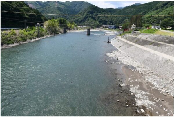
By the way, when I looked downstream from the temporary bridge, I could see two or three structures that appeared to be bridge piers still standing. I believe these are the remains of the Second Kuma River Bridge on the JR Hisatsu Line. As I’ll mention later, much of the JR infrastructure seems to have been left untouched since the disaster.
Drive-in Washed Away Along With the Ground Beneath It
The section of National Route 219 under delegated authority is approximately 50 km long. Restoration work is underway throughout the area.
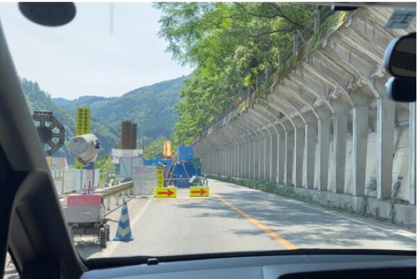
I estimated there were at least several hundred construction sites, but since the number of sites fluctuates daily, the official stated, “We do not have any published figures” (ibid.). While most of the construction is concentrated on the river-side lanes of the road, there were also several sites where slope stabilization work was underway. As a result, there are numerous sections with one-way traffic.
As we approached a certain curve, he said, “There used to be a drive-in here.” When I looked, there was nothing beyond the guardrail.
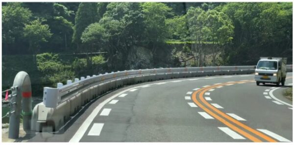
“There’s nothing left, is there? It was swept away, along with the ground beneath it,” he continued. When I looked into it later, it seemed to be the site where the “Drive-In Ajisato” used to be. Judging by the sharp bend in the river, a remarkably powerful current must have formed and swept the entire area away. I felt as though I’d caught a glimpse of one side of the “wild Kuma River.”
Looking across the river from National Route 219, you can see what appear to be white block mats—used for emergency repairs to the riverbank—scattered here and there. Behind them runs a prefectural road. On a slightly higher level behind the prefectural road, you can also see what looks like a guardrail stretching along the edge. That’s the JR Hisatsu Line.
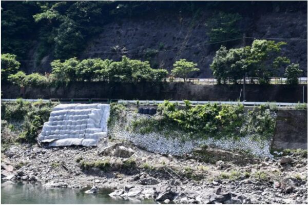
Currently, repairs to this prefectural road are also being carried out under delegated authority; however, because the road is narrow, it is impossible to secure a work area while traffic continues to pass through.
So, they decided to repurpose the JR Hisatsu Line tracks—which run parallel to the prefectural road—as an alternative route. They’re having vehicles use this route while construction continues on the prefectural road. They’re paying a usage fee to JR. Apparently, using railroad tracks as an alternative route for emergency repair work is quite rare nationwide.
Does JR have any intention of resuming service on the Hisatsu Line?
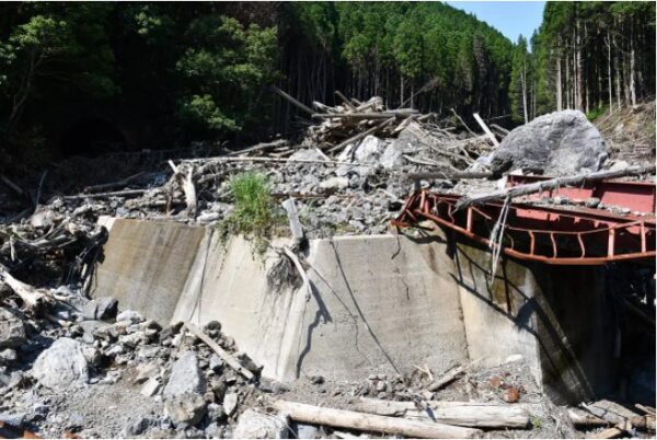
The JR Hisatsu Line suffered catastrophic damage in this flood. The Setoishi Station building, along with surrounding facilities, was completely swept away, leaving no trace; bridges were washed away, and the tracks were buried under mud and debris. Service remains suspended, and JR is operating replacement taxis. What surprised me was that the sediment and driftwood piled up on the tracks have been left untouched.
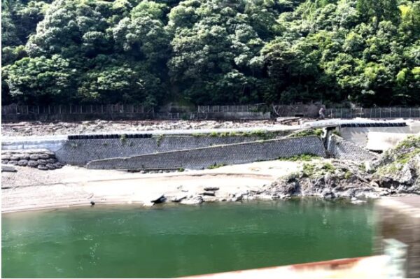
I wondered, “Does JR Kyushu really intend to resume operations?” After all, restoration would likely cost several billion yen, and there seems to be no prospect of recouping that kind of investment. Continuing service via taxis and buses rather than trains might be the more realistic option.
Yatsushiro City Aims for a 1.2-hectare Site Raised by 3 Meters
To wrap up this reporting trip, I stopped by Sakamoto Station in Sakamoto-cho, Yatsushiro City. In this area, the water had risen as high as the station building. The Sakamoto Branch Office—a branch of the city government—was also damaged by the disaster; it has since relocated and is currently operating out of a temporary office.
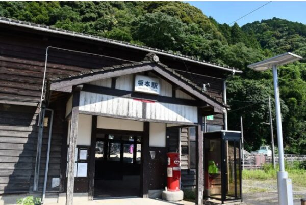
However, a factory near the station—which appeared to be an ironworks—had resumed operations at its original location. Learning from the lessons of this flood, Yatsushiro City plans to raise the elevation of approximately 1.2 hectares in the Sakamoto Branch Office area by about 3 meters. Moreover, since they say they intend to complete this by fiscal year 2024, it is a rather bold policy.
When I asked an official from Yatsushiro City about this, he said, “We still need to build consensus with residents and secure funding.” I couldn’t help but ask, “Are you really sure that’s going to work?” but they replied matter-of-factly, “Yes, that’s how we’re proceeding for now.” “So this is what they call ‘creative reconstruction,’” I thought to myself. I had a lot I wanted to say, but I decided to hold my tongue for now and simply wait to see how things unfold.
The road to recovery and reconstruction is still a long one
When I visited the disaster-stricken area for the first time in 10 months, I realized that “there is still a long way to go in the recovery and reconstruction efforts following the Kuma River flood.”
This is because, under the banner of “creative reconstruction,” urban development in disaster-stricken municipalities is closely linked to the restoration of infrastructure such as roads and rivers. I can only hope that this political slogan does not become a “shackle” that hinders recovery and reconstruction efforts.
From the God of Construction