

Hello, everyone.
This is Enta.
The other day, Director Jou contacted me and said, “We’re releasing this!”
And on top of that, I've downloaded two free apps since the start of July.
Both of these are things you can use right away on the job.
But that's beside the point.
In this post, we’ll introduce “Control Point Navigator” and “Standard Values Pocket,” both developed by Director Jou.
Since Director Joe is also a sponsor of this blog, I imagine many of you are already familiar with him.
Control Point Navigator | Track Hidden Control Points Using Arrows and Remaining Distance
First up is this.
*Currently available only on Apple (iPhone).
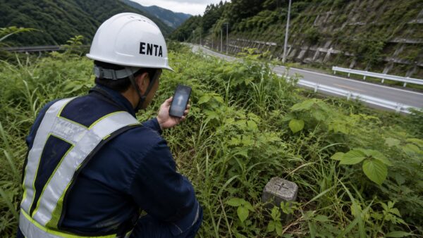
You’ve probably had the experience of walking all over the place, looking for reference points hidden in the dirt or grass, right?
This app is designed to cut that time right out. (It’ll lower your daily step count, lol.)
・Real-time display of the current location's planar Cartesian coordinates (Series 1–19)
・When you import control point data in CSV or SIMA (.sim) format, the app will guide you to the selected point using an arrow and the remaining distance.
・When there are 5 meters remaining, the display changes to "Search this area."
・"Camera Guidance," which superimposes a pin indicating the target direction onto the camera feed
・Align a DXF floor plan with the actual site (using the two-point method or the one-point plus direction method) so that a current location marker moves within the drawing—"Walk Through the Drawing"
・You can choose from Geospatial Information Authority of Japan maps (Standard, Light-colored, and Photographic), Apple Maps, and white maps as your basemap.
Both Cima and CSV files can be imported as-is.
You can also include drawings.
I've heard that it can also automatically identify TREND-type column sequences.
It's a really handy app, especially for people who do surveying, isn't it?
However, I’ll make sure to explain the issue of accuracy clearly.
It uses the iPhone's built-in GNSS, which has an accuracy of a few meters.
It is optimized for quickly determining the "approximate location" of reference points and cannot be used for applications such as surveying or as-built measurements.
On the other hand, the coordinate transformation algorithm is based on the Geospatial Information Authority of Japan’s calculation formula and has been verified to match within 1 mm at known points.
In other words, it's a tool that helps you quickly find reference points.
No account registration required, no ads.
Both location data and imported data are processed entirely within the device, with no data transmitted externally.
It's free and available exclusively for iPhones running iOS 17 or later.
Standard Value Pocket | Draw standard values for finished parts in just three taps
And this is what came out a few days later.
*Apple devices only (iPhone)
I've been really looking forward to this.
This app lets you instantly display the answer to "What was that specification value again?" with just three taps right on the job site!!
・Navigate through the work category tree (Part → Chapter → Section → Work Category) or use a keyword search to find the desired standard value.
・Supports phonetic search. Results will appear even if you search using the readings "Yōheki" or "Norimen."
・Reference values and standard values are displayed exactly as they appear in the original text. Standard values for various conditions, such as length and classification, are also included.
・Overview of point-based and area-based management modes, measurement criteria (frequency), and measurement location diagrams on cards
・You can pinch to zoom in on the measurement location diagram to see the details.
・Includes favorites and a history of recently viewed items
・Works completely offline
This is absolutely essential on the job.
I downloaded it right away.
There's no cell service out in the mountains, after all.
The fact that it works offline is a huge plus, huh? lol
It's also a relief not to have to carry around a thick manual on site.
According to the information provided, this app is based on the published “Standards and Specifications for Civil Engineering Construction Management (Draft)” (Kinki Regional Development Bureau) and has been edited and formatted for easy viewing.
The basics are the same nationwide, so there's no problem.
It appears that the datasets for fiscal year and ordering agency are of the replaceable type, meaning they are not automatically updated but must be manually loaded within the app.
In real-world situations, I rarely open apps like this.
Especially the veterans—since they’ve been using these standard values for so many years, they must know them by heart!!
But it happens sometimes, doesn't it!?
Huh? What was that again??
It's something you need for those times when you dig deep into your memory but still end up thinking, “Huh?”
That's exactly when you need it, isn't it?
You don't need it on a daily basis, but even if you only use it a few times a year, it's definitely handy to have—and it's a must-have for young professionals!
Personally, I'm looking forward to seeing this get localized into other languages lol
The role of a director will become more diverse in the future.
After all, foreign visitors need to be aware of the standard values, too.
I'm actually thinking about developing an app like this, specifically for slopes, too ^^

An Era When Civil Engineers Can Release Their Own Apps
We just released a web app for measuring stone walls the other day, too.
Things that used to be possible only for IT companies can now be easily done by us ordinary civil engineers as well.
This is truly amazing.
After all, there's no need to call on an IT contractor every single time.
We have a clear vision of what we want to create, and we also have the answers to make it happen.
Up until now, we’ve just thrown our ideas at the IT folks, and they could only come up with the answers we asked for. (They have a hard time thinking outside the box.)
However, we now live in an era where we can shape our own answers, drawing on our own experiences.
Director Jou is a civil engineer who has worked on public civil engineering projects as a site representative and supervising engineer, so it goes without saying that this app is based on his solid understanding of real-world site conditions.
The description for "Benchmark Nav" even says, "An app created by a surveyor from a field perspective, for use in the field," lol.
Well, that really hits the spot, doesn't it?
After all, it's being created by the very person who's facing the problem on-site.
This trend is likely to accelerate rapidly.
New apps are popping up all the time.
We’ve entered an era where things that used to be dismissed as “inconvenient” are now becoming a reality.
We’d like to build our own system, wouldn’t we?
I’ve come to truly realize that products created by people who know the field inside and out are ultimately the strongest.
See you later.